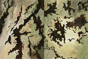
Art + Maps exhibit open now at CU-Boulder
A new exhibit, Art + Maps, is open now through Dec. 12 at the University of Colorado Boulder Jerry Crail Johnson Earth Sciences and Map Library.
Works by four local and regional artists are exhibited with items from the Map Library collection. Corresponding maps range from antique maps to aerial photographs; celestial charts to contemporary expressions of map design.
The exhibit, curated by Naomi Heiser, features:
- Enhanced remote-sensing images by Karl Mueller, CU-Boulder Geological Sciences Department
- Quilts by Barbara Olson, Boulder fiber artist
- Paintings by Alan Paine Radebaugh, New Mexico painter
- Pen and watercolor works on paper by Michael Theodore, CU-Boulder College of Music, Theory and Composition Department
Natural forms and earth processes inform the work of these four artists. The juxtaposition of art and maps highlights their formal similarities, yet also reveals elements and functions showing where the purposes of the two formats diverge. A selection of maps emphasizes artistry in cartographic production from various time periods and cultures. Several attributes particular to maps, such as decorative borders, cartouches, and directional signs are displayed.


